When you manage or market commercial properties, you’re constantly balancing risk, cost, and uptime. Roof leaks, failing insulation, overloaded electrical components, or hidden moisture don’t just threaten your building—they threaten your operations, your tenants’ trust, and your brand.
Drone-based FLIR infrared thermal imaging gives you a fast, safe, and highly detailed way to see problems before they become emergencies. For property owners, facility managers, and marketing leaders, it’s becoming an essential part of a modern building health strategy.
In this article, we’ll unpack how drone FLIR thermal imaging works, where it adds the most value, and what to expect from a professionally executed inspection.
What Is Drone FLIR Infrared Thermal Imaging?
FLIR (Forward Looking Infrared) is a leading thermal imaging technology that visualizes heat instead of visible light. When we pair a FLIR thermal camera with a professional drone platform, we can capture high-resolution thermal data from angles and heights that would be difficult, dangerous, or impossible for a human inspector to reach.
Unlike a handheld infrared scanner that samples a few spots, drone thermal imaging can cover an entire building envelope quickly, producing detailed thermal maps that reveal:
- Temperature anomalies
- Moisture intrusion patterns
- Insulation gaps
- Hot spots in electrical and mechanical systems
This isn’t guesswork. It’s quantifiable, visual data you can share with your facilities team, engineers, executives, and stakeholders.
Why Thermal Drone Inspections Matter for Commercial Buildings
1. Proactive Asset Management
Commercial roofs, façades, and mechanical systems are high-value assets. Traditional inspections typically rely on:
- Visual observation from the ground
- Limited roof walks (often unsafe or incomplete)
- Reactive service calls after a leak appears
Drone FLIR thermal imaging flips that model to proactive maintenance:
- Identifies trapped moisture before it penetrates ceilings
- Flags insulation failures before they drive up energy bills
- Catches overheating electrical components before they fail
This gives you a defensible maintenance roadmap and helps extend the life of your building systems.
2. Safety and Risk Reduction
Any time a person climbs a ladder, walks a steep roof, or navigates around rooftop equipment, you’re accepting risk—both for individuals and for your organization.
Drone thermal inspections:
- Minimize time spent on ladders and roofs
- Reduce fall risk and OSHA concerns
- Allow inspection of difficult or unsafe areas (steep slopes, skylights, fragile surfaces)
In many cases, we can complete a full initial thermal scan without anyone setting foot on the roof.
3. Operational Efficiency and Speed
A comprehensive manual inspection of a large commercial building can take days, sometimes longer, especially if you rely on multiple contractors. With drone FLIR imaging:
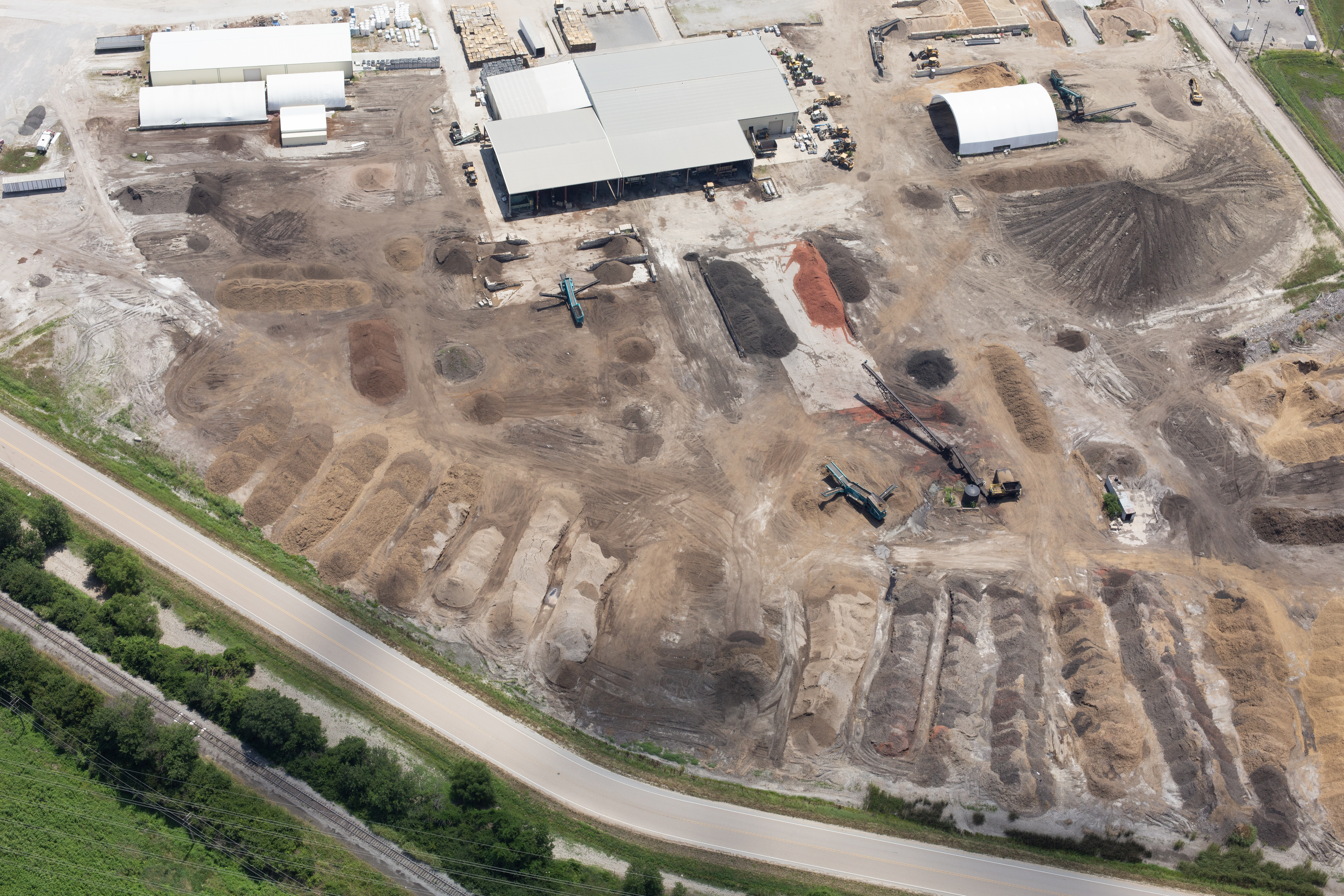
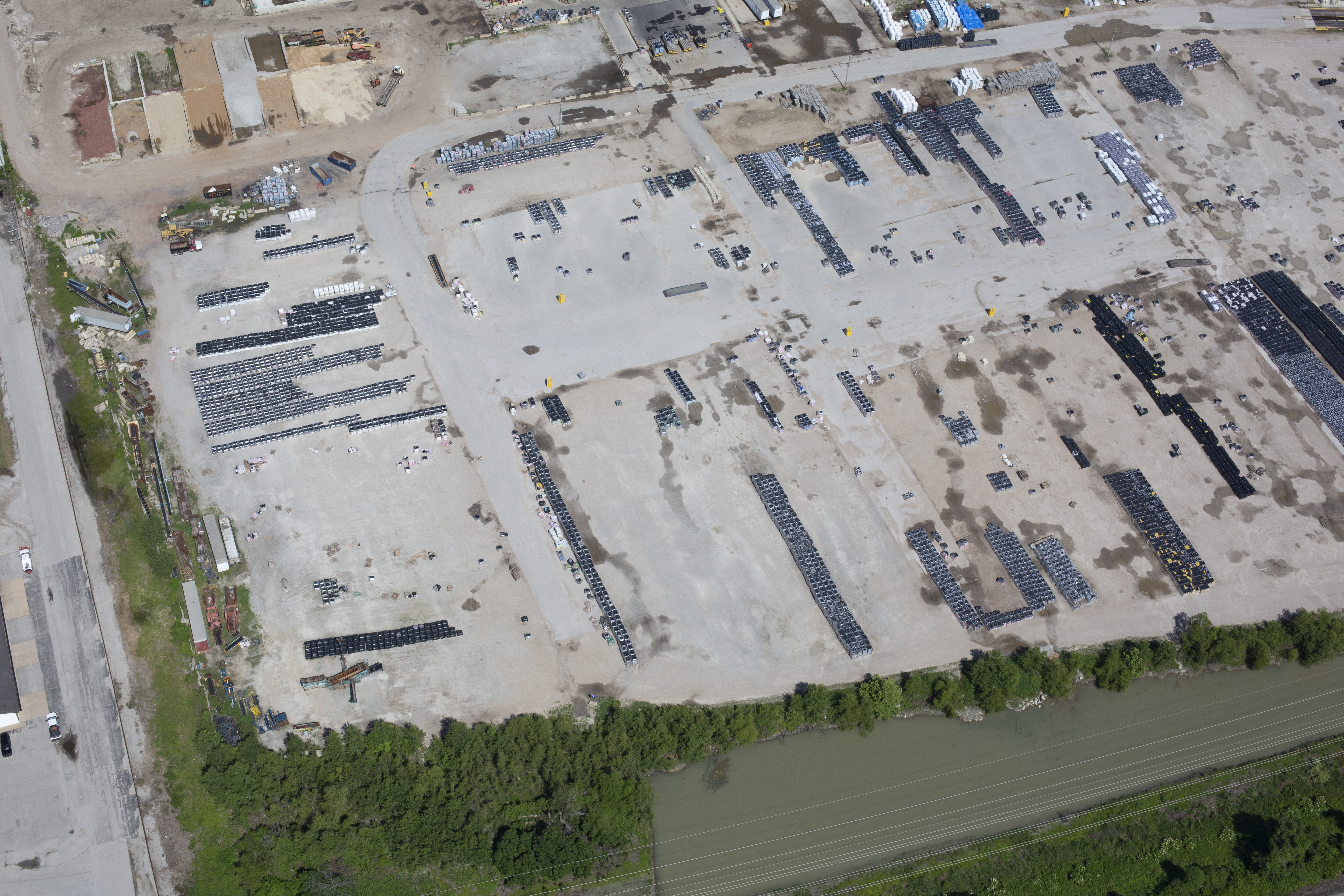
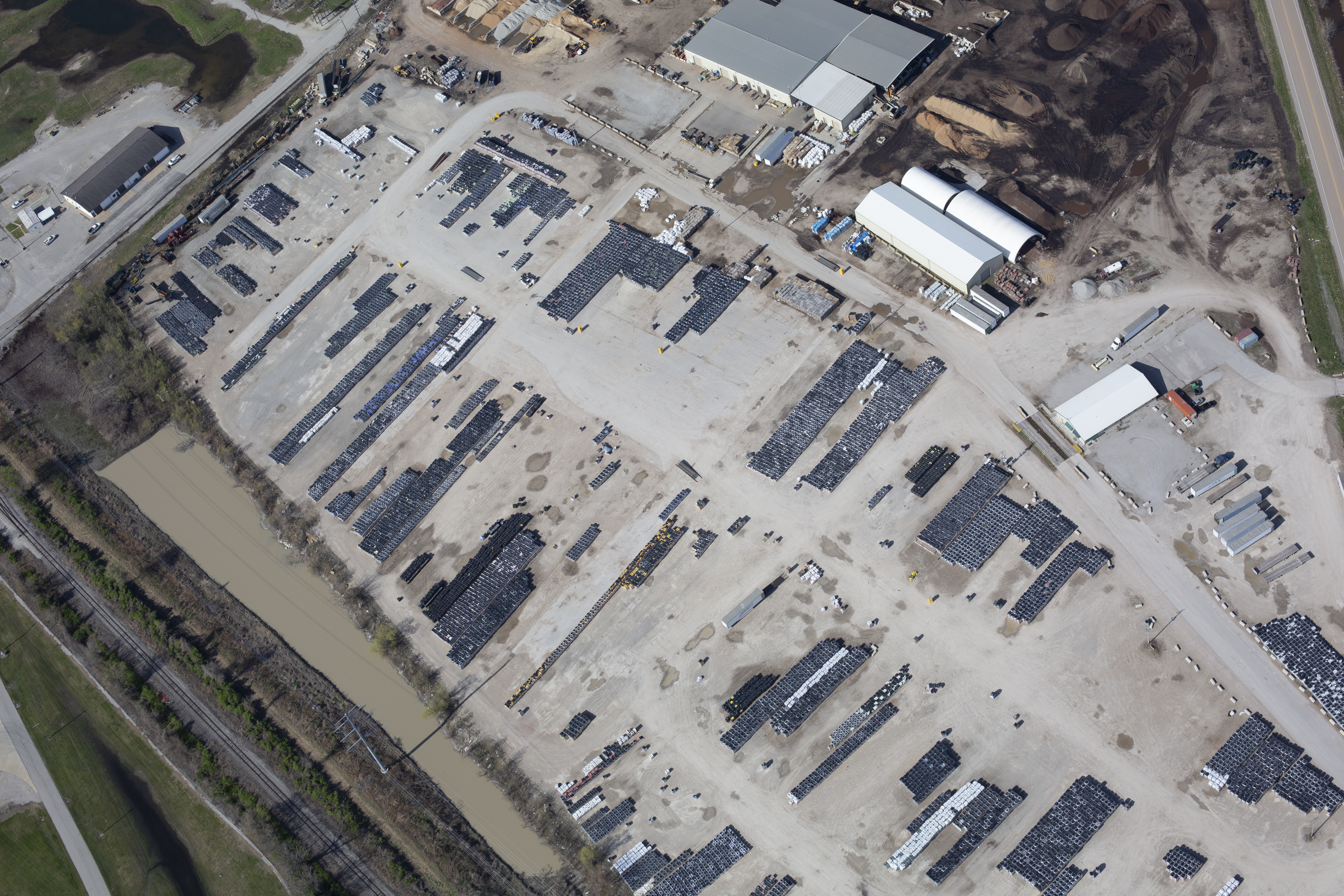
- Large roofs and building exteriors can be scanned in a fraction of the time
- Multiple building sections can be documented in a single mission
- You receive both visual and thermal data in a structured format that’s easy to review and share
The result: less disruption to your operations, tenants, and facility teams.

Where Drone FLIR Imaging Delivers the Most Value
Roof Moisture and Leak Detection
Flat and low-slope roofs are especially vulnerable to hidden moisture. Water often migrates laterally within the roofing system, making the visible leak location different from the source.
Thermal drone imaging helps you:
- Pinpoint areas of saturated insulation
- Identify compromised sections of membrane or flashing
- Prioritize targeted repairs instead of full replacement
- Provide supporting documentation to roofing contractors and insurers
This saves capital by focusing work on actual problem areas instead of over-replacing.
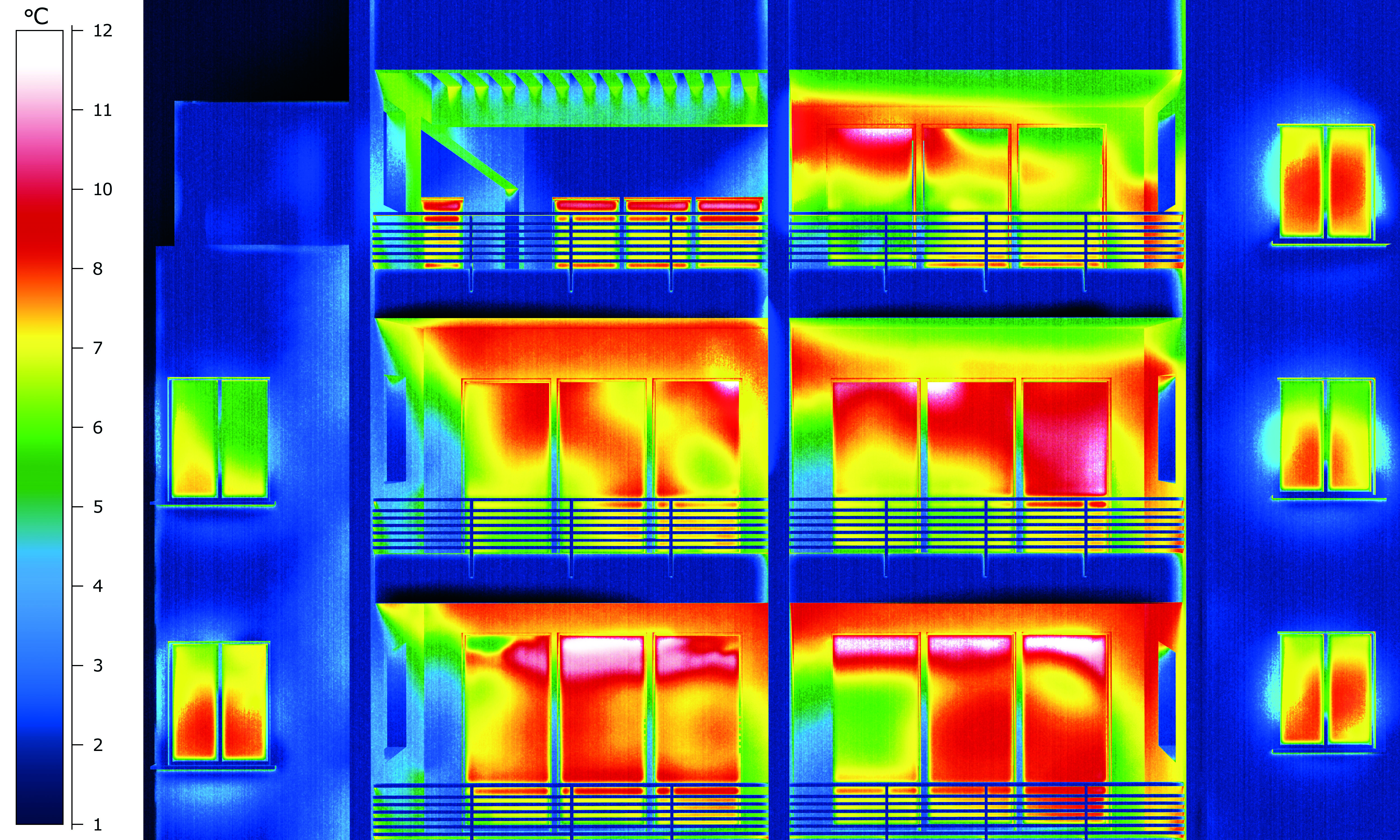
Building Envelope and Insulation Performance
Heat loss in winter and heat gain in summer can significantly affect operating costs. A thermal scan of walls, windows, and rooflines can reveal:
- Insulation gaps or voids
- Air leakage around window and door assemblies
- Thermal bridging at structural elements
- Poorly sealed penetrations and ductwork
Once identified, these issues can be addressed strategically as part of an energy efficiency plan or capital improvement project.

HVAC and Mechanical Systems
Drone thermal inspections can be used to visually assess rooftop units and related mechanical infrastructure:
- Imbalanced temperature patterns across coils or condensers
- Signs of restricted air flow or partial failure
- Excessive heat around motors, bearings, or fan assemblies
When combined with visual imagery, this data helps maintenance teams schedule repairs before a unit fails during peak demand.
Electrical and Solar (PV) Systems
Thermal imaging is a proven tool for identifying electrical issues:
- Overheating breakers, bus bars, or connections
- Undersized or overloaded conductors
- Hot spots within electrical cabinets (viewed safely from a distance)
For solar arrays, drone-based FLIR imaging helps detect:
- Faulty panels or strings
- Soiling patterns and shading impacts
- Inverter and connection anomalies
Early detection protects both safety and production performance.
How a Professional Drone Thermal Inspection Works
1. Pre-Planning and Flight Design
We begin with a discovery conversation and a review of your site:
- Building footprints, roof layout, and heights
- Known problem areas and history of leaks or failures
- Operational limitations and safety considerations
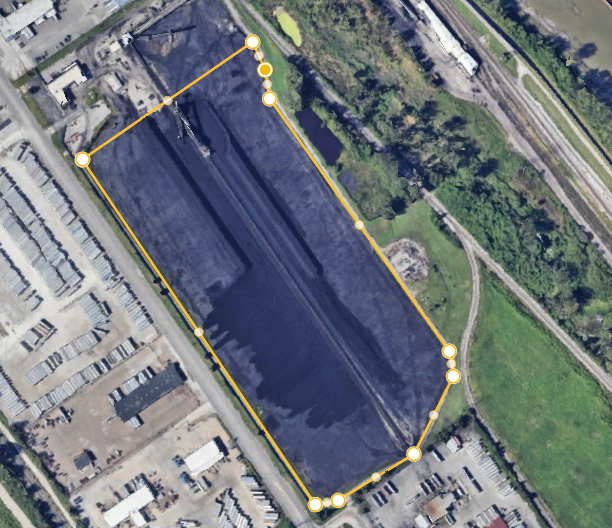
From there, we design a flight plan that ensures full coverage, proper overlap for post-processing, and compliance with FAA regulations and local airspace rules.
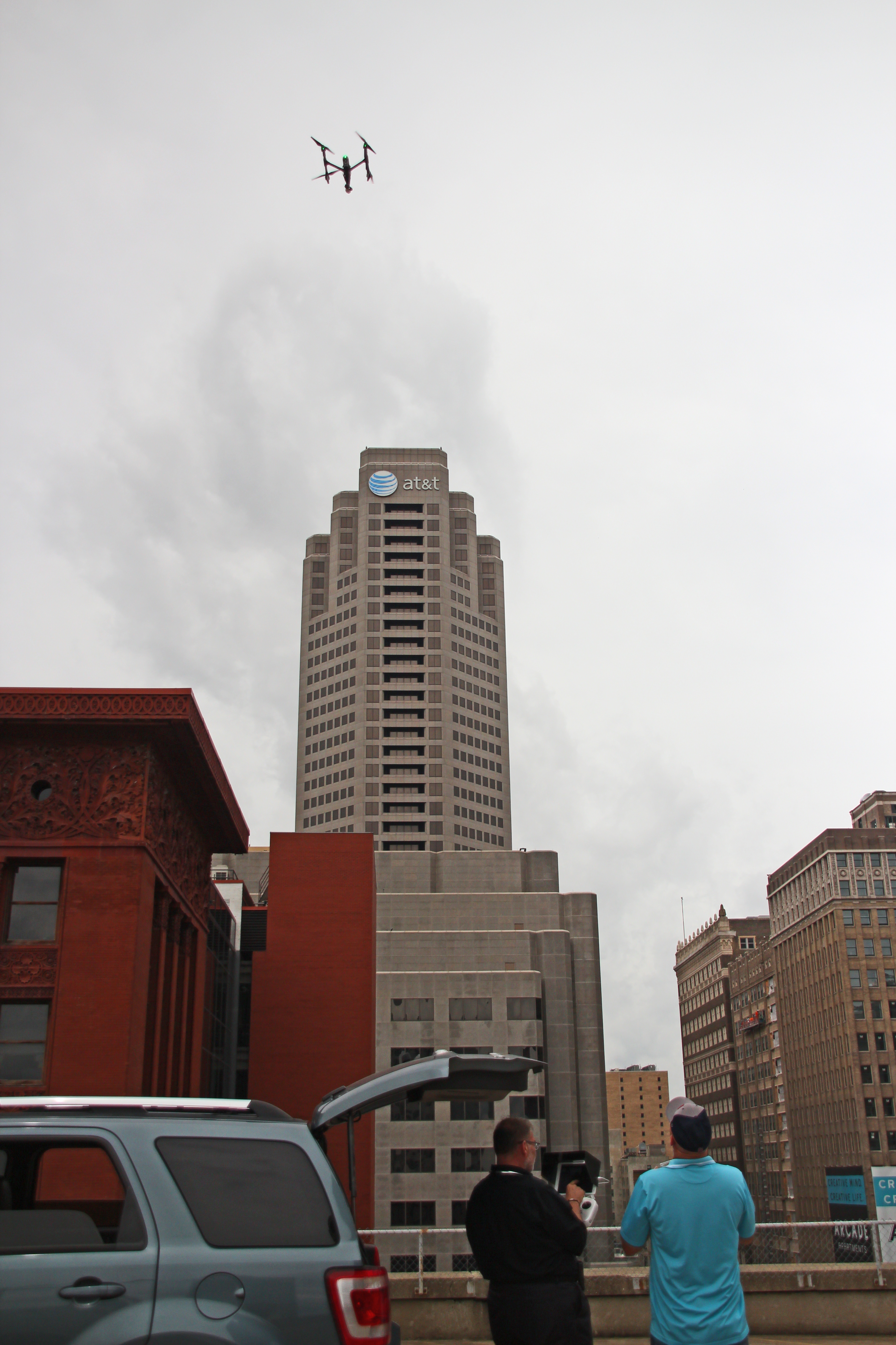
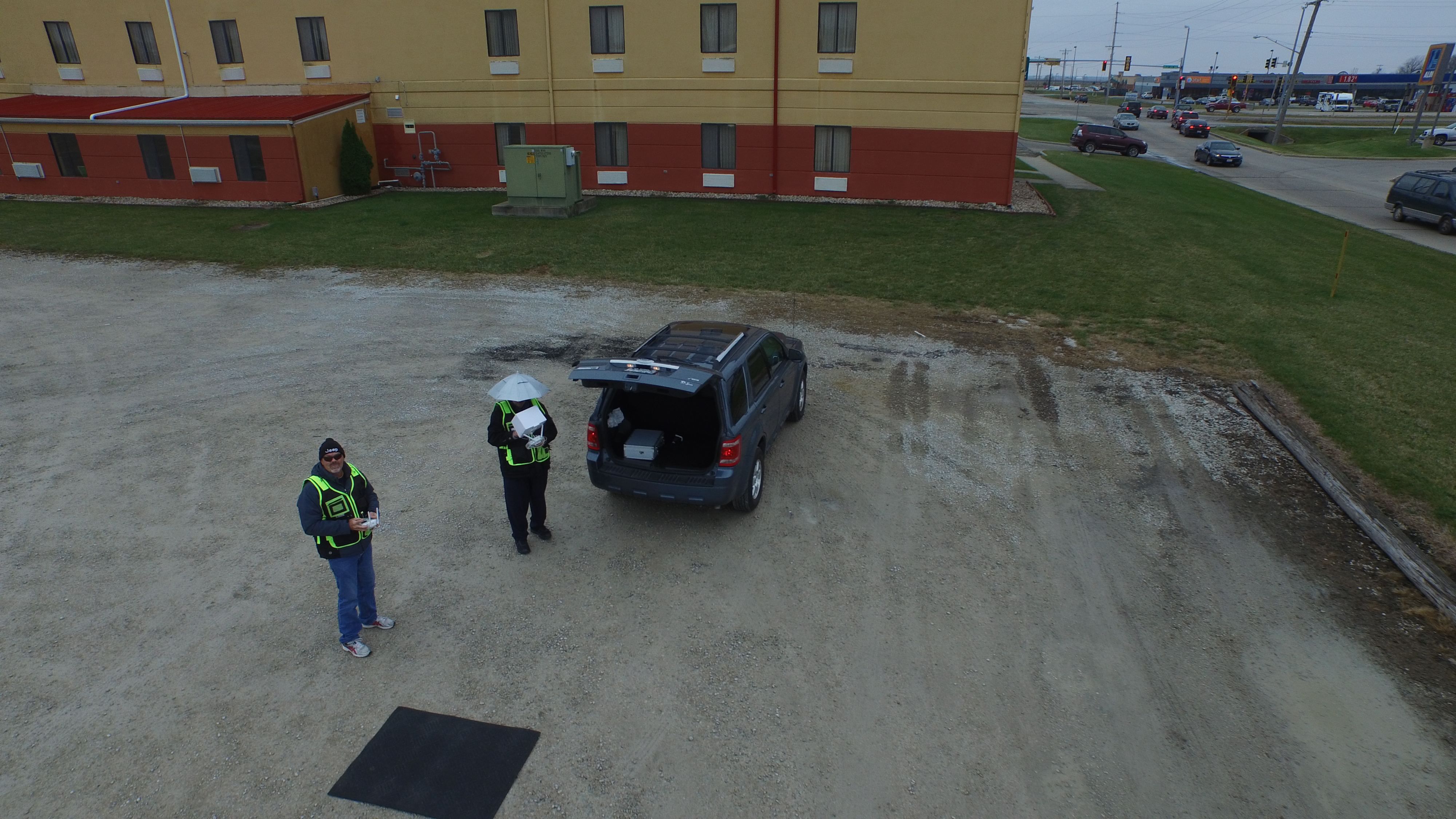
2. On-Site Preparation and Safety
On the day of the inspection, we:
- Conduct a pre-flight safety briefing
- Review the flight plan with stakeholders or facility staff
- Establish safe takeoff and landing zones
- Verify weather and environmental conditions are appropriate for thermal work
Temperature differentials between interior and exterior surfaces are critical for quality thermal data, so we schedule flights when conditions are optimal.
3. Data Capture: Thermal and Visual
Our flight operations capture both:
- Thermal imagery (from FLIR radiometric cameras for accurate temperature data)
- High-resolution visual imagery (RGB) for context and documentation
We typically fly grid patterns at defined altitudes to ensure consistent coverage. For complex areas, we may complement aerial data with closer passes or indoor flights where appropriate.
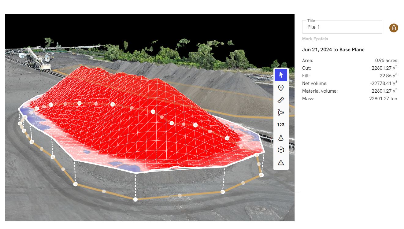
4. Post-Production and Analysis
After the flight, we:
- Organize and calibrate thermal imagery
- Align thermal images with visual photos and building plans
- Use advanced software and AI-assisted tools to analyze anomalies, temperature gradients, and patterns
AI helps accelerate pattern recognition, unify datasets, and enhance clarity of reports, but human expertise still leads the interpretation, especially for nuanced building and roofing conditions.
5. Reporting and Actionable Recommendations
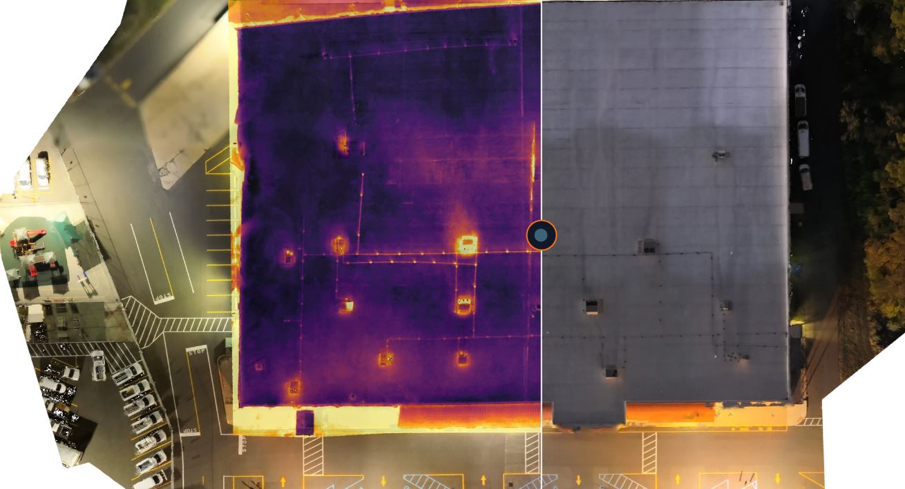
You receive a structured deliverable that may include:
- Thermal maps of roofs, walls, and building sections
- Side-by-side thermal and visual image pairs
- Annotated images highlighting areas of concern
- Summary of findings and suggested next steps
This report becomes a living document that you can share with executives, facility management, roofing contractors, and insurers.
Marketing, Documentation, and Stakeholder Communication
Beyond maintenance and engineering, thermal drone data has value for your marketing and communications teams:
- Demonstrate proactive stewardship of facilities and infrastructure
- Support ESG and sustainability reporting with concrete visuals
- Show tenants and investors you’re investing in building health and efficiency
- Create visual assets that simplify technical discussions for non-technical stakeholders
Professionally produced thermal and visual imagery can be repurposed for presentations, investor decks, annual reports, and digital communication.
What to Look for in a Drone Thermal Imaging Partner
Not all drone operators or photographers are equal when it comes to commercial building inspections. When evaluating partners, consider:
- Experience with commercial and industrial facilities – Not just “pretty aerial photos,” but real inspection-grade work.
- Radiometric thermal capability – Ability to capture and interpret actual temperature data, not just colorful images.
- Workflow and deliverables – Clear reporting, organized data, and formats that your teams and vendors can actually use.
- Safety and compliance – Licensed pilots, liability coverage, and familiarity with FAA regulations and local operating requirements.
- Integration with your broader visual strategy – Ability to support not just inspections, but also brand storytelling and marketing content about your facilities and capabilities.
When you can consolidate inspections, photography, video, and post-production under one experienced provider, you gain consistency, efficiency, and a stronger visual narrative about your organization.

Why Partner with St. Louis Corporate Photographer for Drone FLIR Thermal Inspections
Drone-based FLIR infrared thermal imaging is most powerful when it’s integrated into a broader visual and technical strategy for your buildings. That’s where an experienced, full-service team makes a difference.
St. Louis Corporate Photographer is a full-service professional commercial photography and video production company with the right equipment and creative crew service experience for successful image acquisition. We offer full-service studio and location video and photography, as well as editing, post-production and licensed drone pilots. St. Louis Corporate Photographer can customize your productions for diverse types of media requirements. Repurposing your photography and video branding to gain more traction is another specialty. We are well-versed in all file types and styles of media and accompanying software. We use the latest in Artificial Intelligence for all our media services. Our private studio lighting and visual setup is perfect for small productions and interview scenes. Our studio is large enough to incorporate props to round out your set. We support every aspect of your production—from setting up a private, custom interview studio to supplying professional sound and camera operators, as well as providing the right equipment—ensuring your next video production is seamless and successful. We can fly our specialized drones indoors. As a full-service video and photography production corporation, since 1982, St. Louis Corporate Photographer has worked with many businesses, marketing firms and creative agencies in the St. Louis area for their marketing photography and video.
If you’re ready to add drone FLIR thermal imaging to your commercial building inspections—and tie that data into a cohesive visual story for your stakeholders—our team is ready to help.