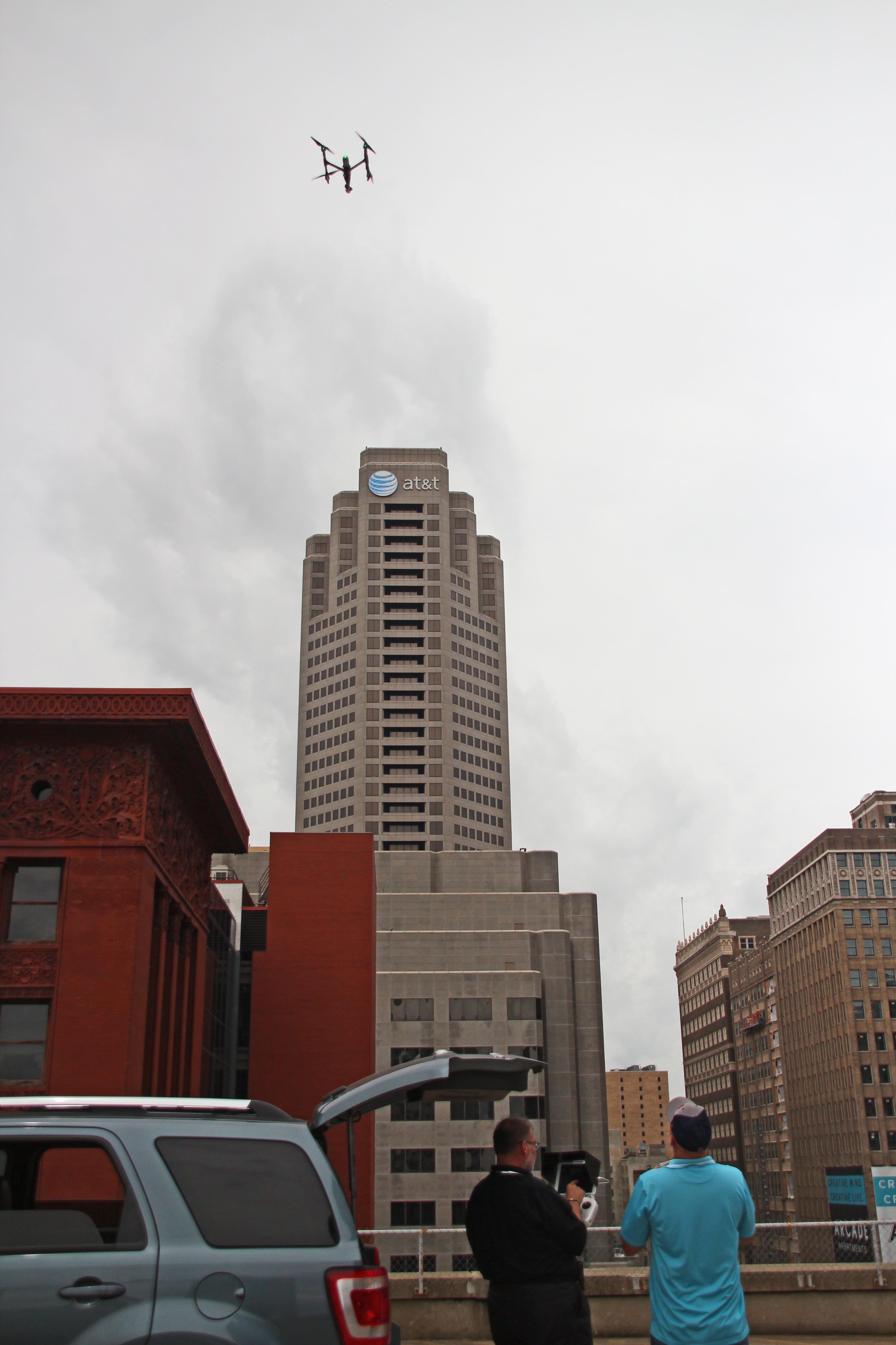
For many organizations, aerial photography used to mean one thing: a high, wide shot that made a property or project look impressive. That still has value, but commercial clients increasingly expect more from drone imaging. They want visuals that can help them inspect, document, explain, and evaluate real-world conditions. They want aerial coverage that is useful, not just attractive.
That is one reason LiDAR and thermal FLIR infrared drone services have become so relevant in the St. Louis market. These technologies add a deeper layer of visual understanding for businesses that manage buildings, facilities, land, infrastructure, equipment, and large commercial properties. They can help reveal patterns and conditions that are difficult to capture through standard photography alone.
At St Louis Corporate Photographer, we see advanced drone imaging as part of a larger commercial communication and production strategy. The value is not simply in flying a drone. The value is in understanding the assignment, choosing the right technology, capturing the right material, and delivering visuals that support both business decisions and professional presentation.
Why businesses are looking beyond conventional drone photography
Traditional drone photography remains an excellent tool for marketing, corporate branding, site overviews, and project updates. It can show scale, context, access, and visual appeal quickly and effectively. But certain projects require more than what visible-light imagery can provide.
A facilities manager may need to better understand a large roof.
A contractor may need more useful site documentation.
A property owner may want a clearer picture of building or land conditions.
An operations team may need a broader way to review hard-to-access assets.
A corporate marketing department may want imagery that shows technical capability as well as visual polish.
LiDAR and thermal drone services answer those kinds of needs in different ways. They are not simply cinematic tools. They are business imaging tools.
LiDAR: a stronger way to understand a site
LiDAR, short for Light Detection and Ranging, uses laser pulses to measure distances and create detailed spatial representations of surfaces and environments. In practical terms, it helps build a more complete picture of terrain, contour, elevation, and physical layout.
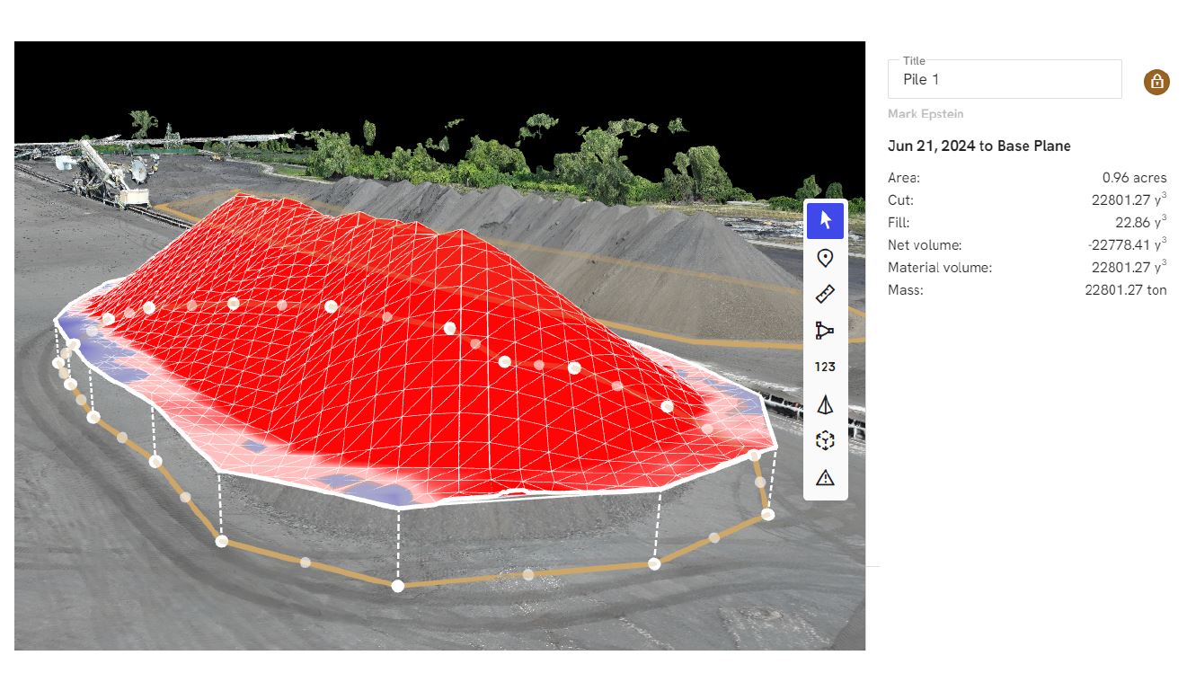
That makes LiDAR especially useful when a project calls for more than a simple overhead image. A photo may show what a site looks like. LiDAR can help define how that site is shaped and organized.
For commercial clients, this can be valuable in environments such as:
construction and development sites
industrial yards and manufacturing properties
large campuses
infrastructure corridors
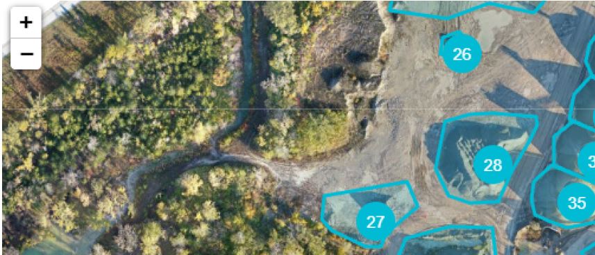
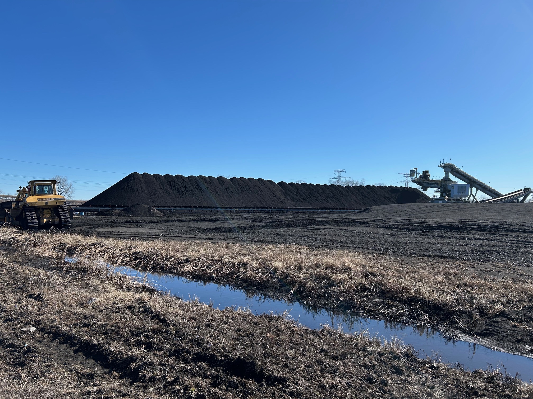
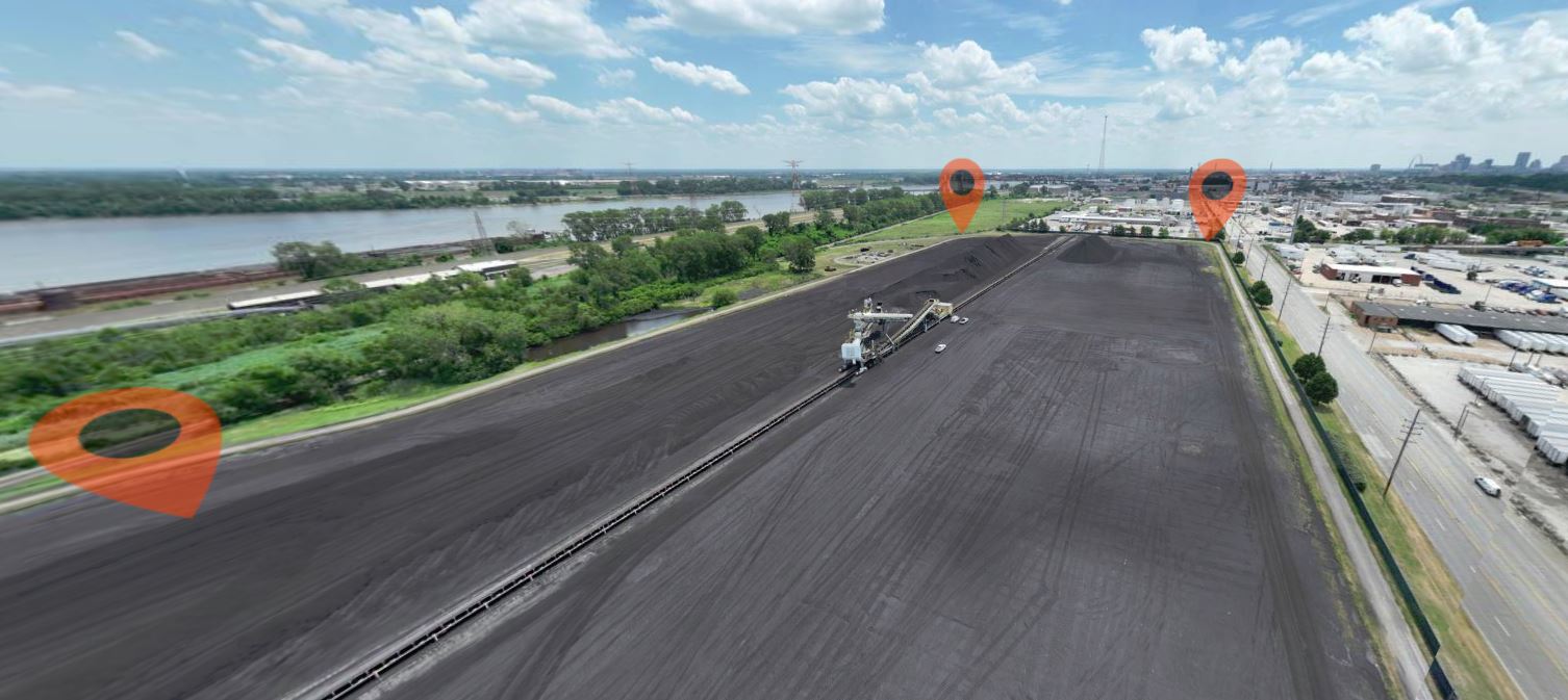
aggregate and stockpile areas
expansive commercial properties
land planning and site documentation assignments
When stakeholders need a more informed understanding of a location, LiDAR can provide a level of clarity that ordinary aerial visuals often cannot.
Thermal FLIR infrared imaging: seeing what the eye misses
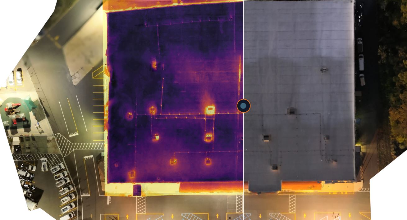
Thermal imaging serves a different purpose. Rather than focusing on visible appearance, it captures temperature differences across surfaces and structures. That allows organizations to identify heat patterns and irregularities that may not be obvious in daylight photography.
For many commercial buildings and industrial properties, this can be extremely useful.
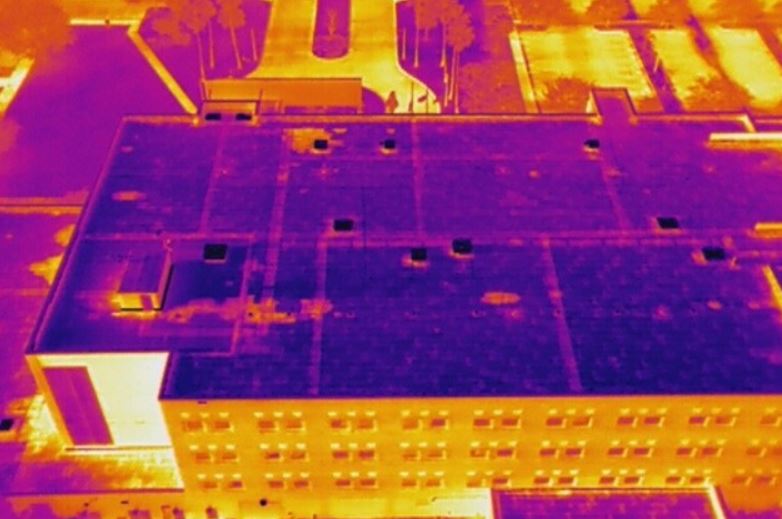
A roof that appears visually consistent may show unusual thermal variation.
A building exterior may reveal heat loss patterns.
A solar installation may display temperature differences across components.
A mechanical or equipment area may show hotspots that deserve closer review.
Thermal FLIR infrared drone imaging helps organizations review large areas more efficiently and can support more informed follow-up by qualified professionals. It does not replace engineers, roofing consultants, electricians, HVAC specialists, or inspectors. It gives them and their clients better visual information to work from.
A practical service for St. Louis commercial environments
The St. Louis area includes a wide variety of commercial and institutional properties where advanced drone imaging can be highly beneficial. Hospitals, schools, corporate campuses, industrial buildings, logistics centers, construction sites, municipal properties, retail centers, and office facilities all present visual challenges that are difficult to solve from the ground alone.
These properties are often large, busy, elevated, or complex. In many cases, a conventional walk-through or standard exterior photo set will not provide enough perspective.
That is where LiDAR and thermal services can make a difference. They allow organizations to capture broader visibility, better site intelligence, and more useful visual records. They can support property planning, facility review, project communication, and executive reporting. They can also create strong visual assets for presentations, proposals, and marketing materials.
Different tools for different objectives
LiDAR and thermal imaging are often discussed together, but they solve very different problems.
LiDAR is centered on physical structure. It helps capture the shape, contours, and geometry of a site or environment.
Thermal imaging is centered on temperature behavior. It helps reveal heat-related anomalies and performance differences across surfaces or systems.
A project focused on site layout, grade, or topographic understanding may benefit from LiDAR.
A project focused on a roof, building envelope, solar installation, or large mechanical area may benefit more from thermal imaging.
Some assignments may justify both. Others may require only one. The right choice depends on the business objective, site conditions, and intended deliverables.
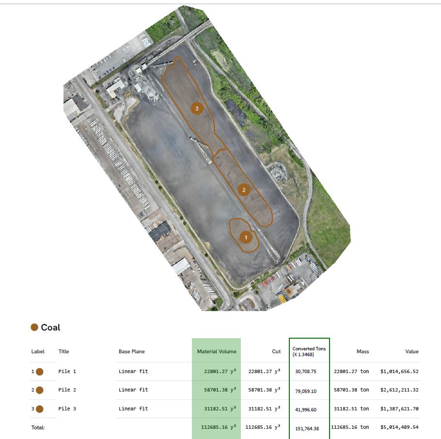
Where LiDAR can be especially useful
LiDAR is a strong fit when organizations need better spatial understanding of a property or worksite.
Construction teams may use it to support documentation and site awareness.
Developers may use it for clearer visual understanding of land and project conditions.
Industrial clients may need a more complete view of yard configuration, access routes, or large outdoor work areas.
Campuses and institutional sites may benefit from detailed site visualization for planning or communication.
Stockpile and material sites may need workflows where shape and volume matter.
In each of these scenarios, LiDAR adds depth to the visual record and helps decision makers interpret a space with greater confidence.
Where thermal drone imaging can add value
Thermal FLIR infrared drone work is especially effective when clients need a broad screening view of heat-related behavior.
Commercial roof evaluations are one of the most common examples. Large roofs can be difficult to review efficiently from the ground, while thermal imagery can help show areas that may warrant closer investigation.
Building exteriors can also benefit from infrared imaging where heat transfer or insulation concerns are part of the conversation.
Solar arrays are another good application because irregular thermal signatures may help reveal underperforming zones.
Industrial and facility management teams may use thermal drone coverage to look for unusual heat patterns across equipment zones, structures, or systems.
The benefit is speed, visibility, and perspective. Instead of relying only on limited ground-level observation, organizations can review a much larger surface area with more meaningful visual context.
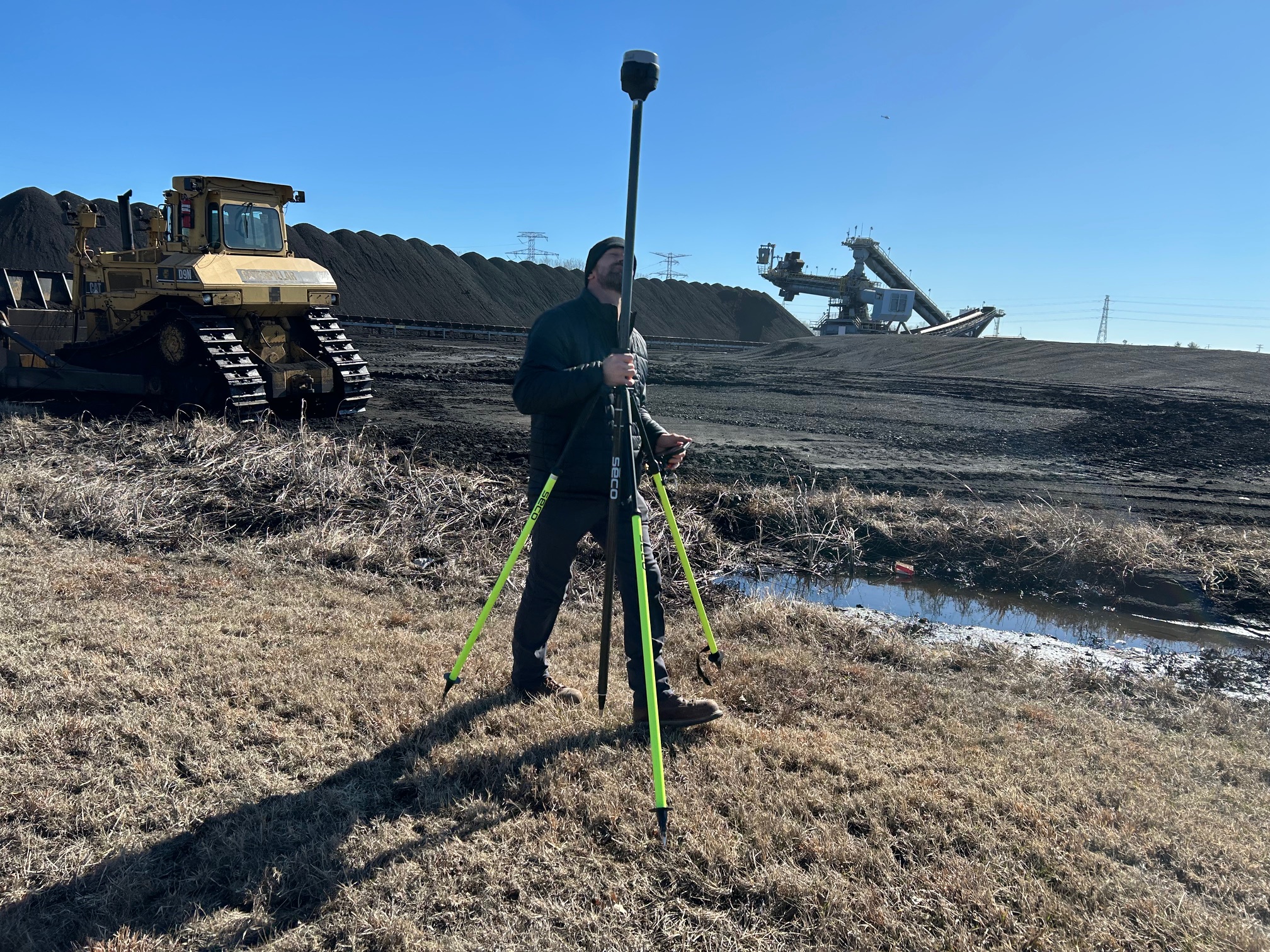
Why planning matters in advanced drone work
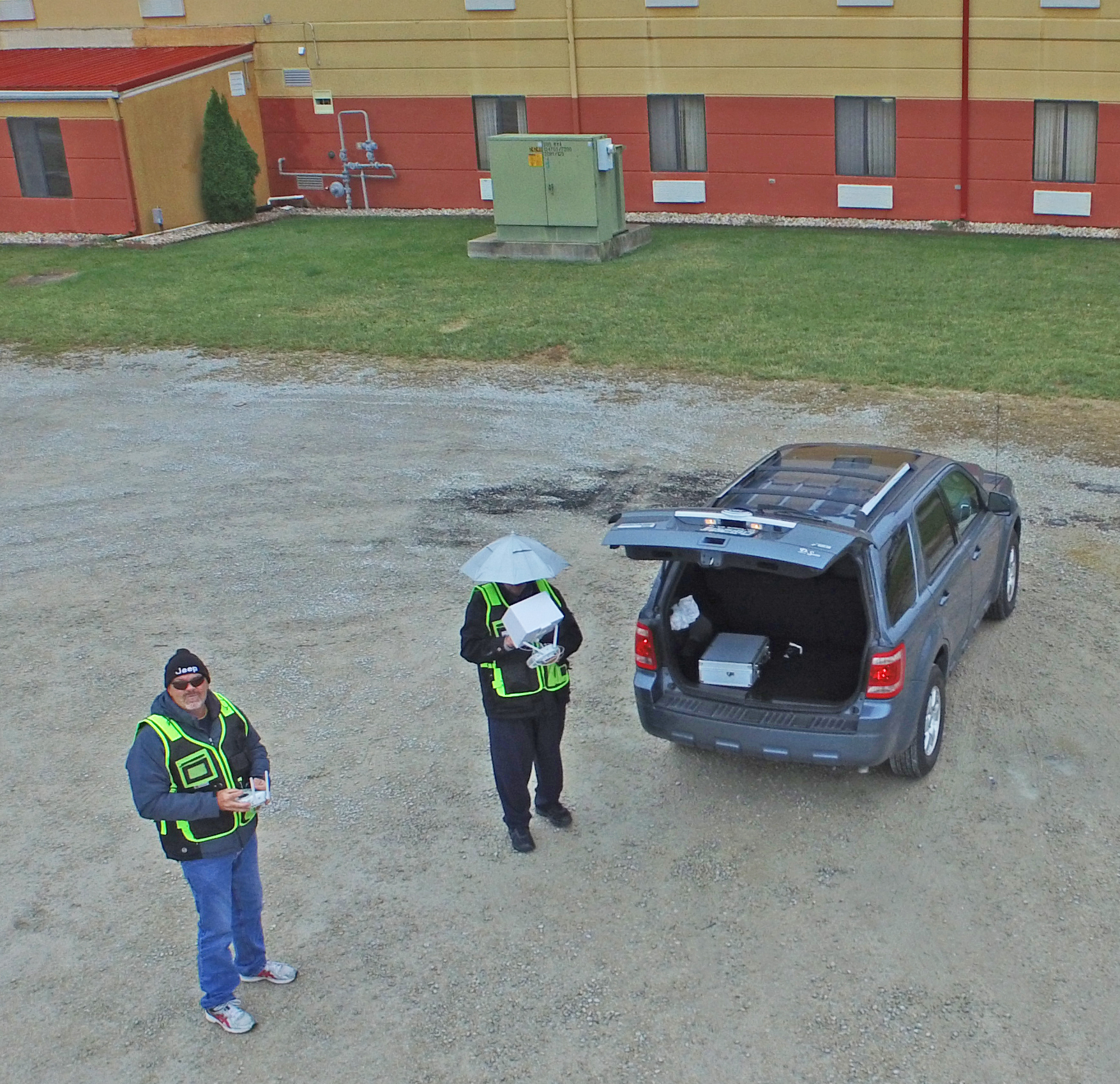
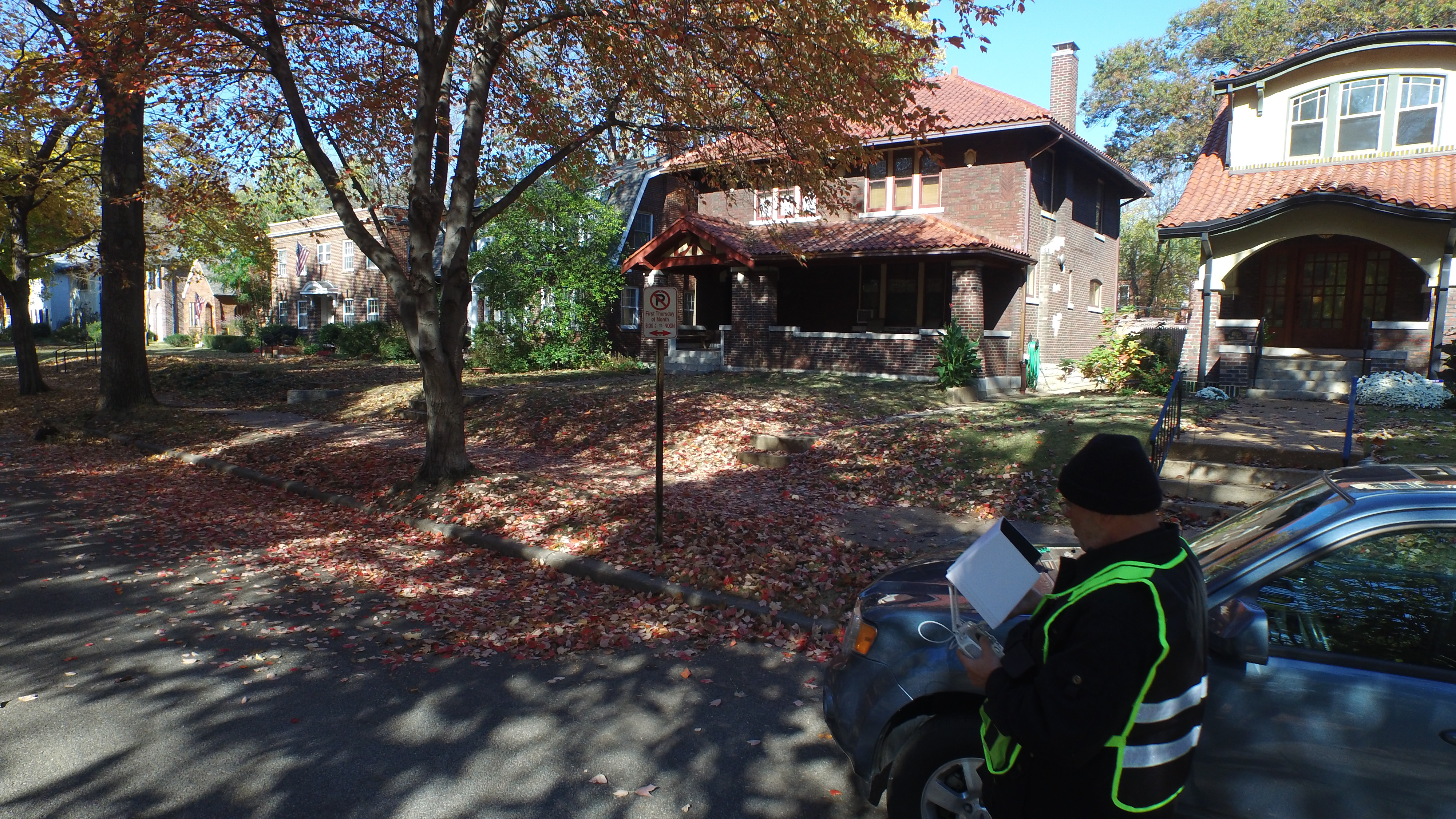
One of the biggest misunderstandings about specialized drone imaging is the idea that the equipment alone determines the outcome. It does not. These assignments depend heavily on planning, workflow, timing, and experience.
Thermal imaging can be influenced by weather, recent rainfall, sun exposure, building materials, and time of day.
LiDAR assignments depend on flight strategy, site conditions, target coverage, obstacles, and how the final output will be used.
That means a successful project requires more than flight skill. It requires production thinking. The team must understand the location, the business objective, the deliverables, and the environmental conditions that affect image quality and usefulness.

Why corporate clients benefit from a production-oriented approach
For corporate clients, advanced drone work often needs to do more than generate raw visual information. It also needs to fit into a larger communication framework.
Images may need to support internal reports.
Visuals may need to be repurposed for client presentations.
Captured material may need to work in case studies, websites, proposals, or investor-facing communications.
That is why working with a commercial photography and video production company can be such an advantage. A production-oriented team can think beyond the flight itself. It can help ensure the visuals are captured in a way that serves practical goals and communication goals at the same time.
In other words, the same assignment can provide both operational value and branding value.
The communication advantage of advanced imaging
There is also a strong reputational benefit to using LiDAR and thermal drone services well. Businesses that present technical visuals clearly often appear more organized, more capable, and more forward-thinking. This can be valuable for contractors, developers, engineering-related firms, property service providers, industrial companies, and corporate teams that want to show professionalism and sophistication.
When advanced drone imagery is captured and presented properly, it becomes more than documentation. It becomes evidence of capability.
That is especially true when the visuals are integrated into polished photography, edited video, presentation graphics, and broader brand messaging.
The future of commercial aerial imaging
Commercial clients increasingly want imagery that helps them do something. They want visuals that inform, clarify, support decisions, and improve communication. LiDAR and thermal FLIR infrared drone services fit that direction perfectly.
They expand what aerial production can accomplish. They make drone imaging more useful for facilities, operations, development, property oversight, and professional storytelling. They help transform aerial capture from a visual extra into a more strategic business asset.
For St. Louis businesses that need stronger documentation, more informed visual reporting, or more advanced property imaging, these services represent an important next step.
St Louis Corporate Photographer for LiDAR and Thermal FLIR Infrared Drone Services
At St Louis Corporate Photographer, we understand that commercial clients need more than attractive images. They need purposeful image acquisition that supports their goals, whether those goals involve facility visibility, project documentation, property communication, technical review, or stronger marketing content.
St Louis Corporate Photographer is a full-service professional commercial photography and video production company with the right equipment and creative crew service experience for successful image acquisition. We offer full-service studio and location video and photography, as well as editing, post-production and licensed drone services. St Louis Corporate Photographer can customize your productions for diverse types of media requirements. Repurposing your photography and video branding to gain more traction is another specialty.
We are well-versed in all file types and styles of media and accompanying software. We use the latest in Artificial Intelligence for all our media services. Our private studio lighting and visual setup is perfect for small productions and interview scenes. Our studio is large enough to incorporate props to round out your set. We support every aspect of your production—from setting up a private, custom interview studio to supplying professional sound and camera operators, as well as providing the right equipment—ensuring your next video production is seamless and successful. We can fly our specialized drones indoors.
Since 1982, St Louis Corporate Photographer has worked with many businesses, marketing firms, and creative agencies in the St. Louis area for their marketing photography and video. When your business needs advanced aerial imaging that goes beyond ordinary coverage, our team brings the production experience, technical capability, and commercial focus required to create useful, professional results.
